
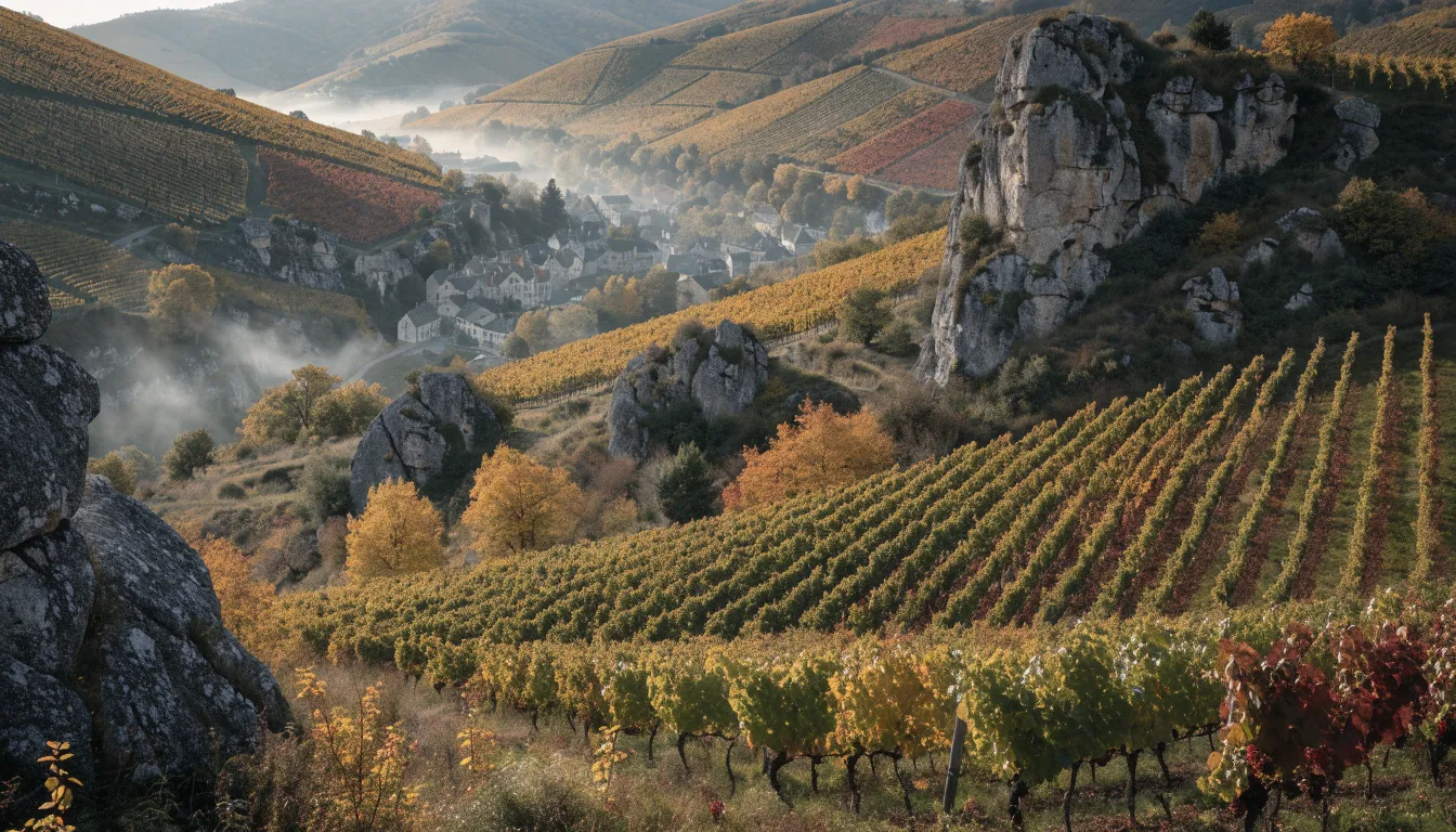
An hour north of Lyon by road, the landscape tightens up. The broad fields of the Saône plain give way to short, steep hills, each one under vines right to the top, separated by side valleys where you cannot see a hundred metres ahead. This is where the ten Beaujolais crus sit: all of them in the northern half of the vineyard, all on soils dominated by granite, all planted with a single grape, gamay noir à jus blanc.
A cru, here, means a village appellation, a commune whose name has been promoted to an appellation in its own right. There are ten, running south to north: Brouilly, Côte de Brouilly, Régnié, Morgon, Chiroubles, Fleurie, Moulin-à-Vent, Chénas, Juliénas and Saint-Amour. Régnié was the last to join the list, at the end of the 1980s. The rest of the region, further south, produces beaujolais and beaujolais-villages on ground that leans more towards clay and limestone. That geological switch, granite to the north and limestone to the south, is the clearest reason the wines do not taste alike.
The whole thing fits in a very small area: from one end of the crus to the other is about twenty kilometres as the crow flies. But those are twenty kilometres of narrow roads that climb, drop and twist, so a full day is not too much. The run below starts at the southern viewpoint and works north into the Saône-et-Loire.
The stops below are geolocated. Click “Show on map” to place one, or “Directions” to start the route from where you are.
-
Mont Brouilly
An isolated knoll in the middle of the vines, a little under 500 metres, with a small chapel on top. The rock here is hard and bluish, unlike the granite that takes over further north. From the summit the whole southern end of the vineyard reads at a glance: rows fanning down the slopes, the Saône plain, and on a clear day the Alps behind. This is where to start, because you understand the map before you drive it.
The pin is approximate, on the Odenas side: it locates the hill, not the car park at the top. The narrow road up starts from the villages at the foot.
About 50 km from Lyon, in the order of 50 minutes by motorway then back roads. Without a car, the regional train serves Belleville-en-Beaujolais at the foot of the vineyard, but the cru villages themselves have no service: you will need a bike, a taxi or a rental car.
-
Beaujeu
The small town that gave the whole region its name, tucked into a side valley away from the line of the crus. It is not an appellation: it was the seat of the lords of Beaujeu, and it still has its Romanesque church, its old houses and a valley-bottom atmosphere that has nothing to do with the slopes. A short detour that puts the name on every label back into context.
Beaujeu sits well west of the cru axis. Reckon on twenty minutes or so of driving there and back from the vineyard.
-
Villié-Morgon
The village behind morgon, and above all the foot of the Côte du Py, a hill of weathered schist that turns brown-red. Growers here call that crumbling rock roche pourrie, rotten rock, and it comes up in every conversation: it is what people usually credit for the frame and the ageing potential associated with morgon.
The pin marks the centre of the commune, not a point in the vineyard. The Côte du Py is clearly visible from the roads climbing north-east out of the village.
-
Fleurie
A village gathered around its bell tower, with a chapel set above it on a shoulder of pink granite. The name no doubt helps the reputation, but the general picture of fleurie, a wine often lighter and more scented than its immediate neighbours, is the description most commonly given locally.
The pin marks the centre of the village. Walk up to the chapel: it is the best place to see how the crus fit into one another.
-
Chiroubles terrace
The highest of the ten appellations, around 400 metres, with a laid-out terrace and an orientation table looking over the whole vineyard. On a clear day the view reaches the Alps. Chiroubles is also the village of Victor Pulliat, the nineteenth-century ampelographer whose work counted in rebuilding the vineyard after phylloxera.
You feel the altitude: a few degrees cooler than down below, and wind almost every time. Bring an extra layer, even in summer.
-
Juliénas
Here you cross into the northern half of the vineyard, hillier, with slopes that close in and hamlets scattered about. Local tradition traces the name back to Julius Caesar, which is worth what village etymologies are usually worth. Saint-Amour, the last cru before Burgundy, is a few minutes away by road.
The pin marks the centre of the commune. The hamlet roads are narrow with no verge: they are widened vineyard tracks, so drive slowly.
-
Romanèche-Thorins
The last stop, already in Saône-et-Loire. This is where the windmill that gave moulin-à-vent its name stands, on a rise of pink granite, long since stripped of its sails but still upright. Chénas, often described as the smallest of the ten by area, begins right next door.
The mill is reached by a small road through the vines. You can walk round it in a few minutes, and the view east is worth the stop. The Hameau Duboeuf, in the former station, can also be visited: check opening hours and prices on its official website.
1. Mont Brouilly, to read the map before you drive it
An isolated knoll set among the vines, a little under 500 metres, with a small chapel on top. Its rock is hard and bluish, and it stands out plainly against the granite that takes over further north.
The point of the detour is not only the view, wide as it is: the Saône plain on one side, the line of the crus stretching north on the other, and the Alps at the back when the air is clean. It is above all the one place on the route where you can see the overall geography. Once you drop back into the side valleys you lose any perspective at all.
The pin on the map is approximate, on the Odenas side: it locates the hill, not the car park at the top. The narrow road up starts from the villages at the foot.
2. Beaujeu, the town that named everything else
Beaujeu is not an appellation, and that is exactly why it earns the detour. The town sits in a side valley, off the line of the crus, and it was the seat of the lords of Beaujeu, a medieval lordship powerful enough to leave its name on an entire wine region.
There is a Romanesque church, old houses, and a valley-bottom feel that has nothing to do with the sunlit slopes next door. Reckon on twenty minutes or so of driving there and back from the cru axis. It is the kind of short stop that puts the word you then read on every label back where it came from.
3. Villié-Morgon and the Côte du Py
Back among the crus, and one of the most talked about. Villié-Morgon is the village behind morgon, but the real subject is the hill above it: the Côte du Py, a shoulder of weathered schist that turns brown-red, so crumbly that local growers call it roche pourrie, rotten rock.
That rock comes up in every conversation around here, and it is what people usually credit for the frame and the ageing potential associated with morgon. Take it for what it is: a tendency widely described in the region, not a law. The pin marks the centre of the commune rather than a spot in the vineyard; the Côte du Py is easy to see from the roads climbing north-east out of the village.
4. Fleurie and its chapel
A village gathered around its bell tower on pink granite, with a chapel set above it that serves as a landmark for miles around. The name surely helps the reputation, but the general picture of fleurie, a wine often lighter and more scented than its immediate neighbours, is also what you hear most often on the spot.
Walk up to the chapel, even briefly. It is from there that you best grasp how the crus interlock: Chiroubles above, Morgon below, Moulin-à-Vent on the far side, all within a few kilometres. Here too, the pin marks the centre of the village.
5. The Chiroubles terrace
Chiroubles is the highest of the ten appellations, around 400 metres. The village has laid out a terrace with an orientation table looking over the whole vineyard, and on a clear day the view reaches the Alps. It is the best panorama on the route after Mont Brouilly, and it costs nothing.
Chiroubles is also the village of Victor Pulliat, a nineteenth-century ampelographer whose work counted in rebuilding the French vineyard after the phylloxera crisis. If that interests you, we have given it a whole article: it is one of the most decisive episodes in European wine history.
You feel the altitude here: a few degrees cooler than down below, and wind nearly every time. Bring an extra layer, even in summer.
6. Juliénas, and the northern end
Here you cross into the northern half, hillier and more folded. The slopes close in, the hamlets scatter, and the roads get distinctly narrower. Local tradition traces the name Juliénas back to Julius Caesar, which is worth what village etymologies are generally worth, though the story is a hardy one and someone will tell it to you.
From there, Saint-Amour, the last cru before Burgundy, is a few minutes away. Take care driving in this sector: the hamlet roads are narrow with no verge, they are widened vineyard tracks, and you meet farm machinery round a bend. The pin marks the centre of the commune.
7. Romanèche-Thorins and the windmill
The last stop, already in the Saône-et-Loire. This is where the mill that gave moulin-à-vent its name stands: a stone tower on a rise of pink granite, long since stripped of its sails, but still upright in the middle of the vines.
A small road takes you there, you can walk round it in a few minutes, and the view east is worth the stop. Chénas, often described as the smallest of the ten by area, begins right next door. By this point you have crossed or brushed most of the ten appellations almost without noticing, so tightly are they packed together.
The village is also home to the Hameau Duboeuf, a large visitor site given over to wine and the vine, housed in the former Romanèche-Thorins railway station. It is open to visitors, and it holds particular appeal for families. Opening hours, opening season and prices are worth checking on the official Hameau Duboeuf website before you set off.
Getting there from Lyon
By car, reckon on about 55 km and in the order of an hour to the heart of the crus, by motorway then back roads. It is the realistic option: the villages are close to one another but linked by slow roads.
By train, the regional service reaches Belleville-en-Beaujolais, at the foot of the vineyard. It is a good starting point, but let us be clear: the cru villages themselves have no public transport. From the station you need a bike, a taxi or a rental car. On a bike the climbing is real, this is not a ride across a plain.
And on tasting: whoever drives does not taste. On a route that strings villages together, the simplest answer is a designated driver, or the train to Belleville and a local means of transport from there. Spitting is part of tasting, nobody will take offence, and tasting rooms are used to it. A day in the crus is judged on what you understood, not on what you drank.
Back in Lyon
The crus make more sense when you know what you are looking for. If you want your bearings before setting off, our piece on the history of gamay tells how a long-despised grape became the only one grown across the whole region, and our guide to beaujolais nouveau explains why that November wine has nothing to do with the ten appellations discussed here.
And if you would rather start with the basics before heading up into the vineyard, an introduction to tasting gives you something concrete to hold onto, both the vocabulary and the practical gestures: our guided route takes place in vaulted cellars in the Guillotière district of Lyon, and takes rather less time than the round trip to Beaujolais.