
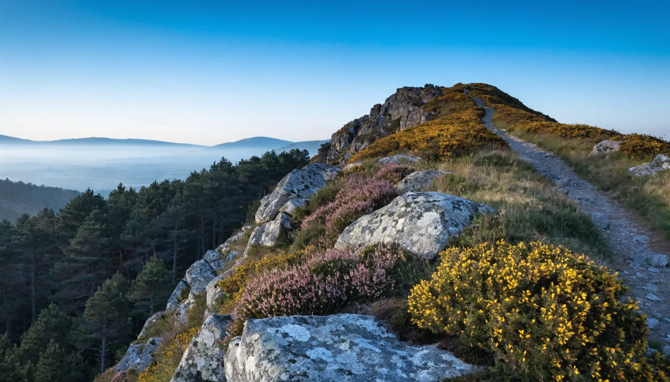
There is a mountain south of Lyon, and a good many people in Lyon forget about it. The Pilat starts an hour away by car, just past Vienne, where the Rhône valley closes in between two steep sides. It is a regional nature park, which in France means an inhabited, working territory rather than a sealed reserve. And above all it is a massif with two faces: on the Rhône side, dry slopes, sunshine and terraced vines clinging to the hillside; on the western side, fir woods, peat bogs and air several degrees cooler. Twenty minutes of driving takes you from one to the other.
The high point, the crêt de la Perdrix, is a little over 1,400 metres. That is not the Himalaya, but it is not the Parc de la Tête d’Or either. At that altitude conditions change fast and hard: it can be glorious in Lyon and windy, cold or entirely fogged in on the crests, with visibility down to a few dozen metres. Look at the mountain forecast on the morning itself, not at the Lyon forecast the night before. Set out in shoes you can walk in, with one layer more than the Lyon thermometer suggests, and with water: between two villages there is nothing. In winter the roads up to the crests can be snowbound, icy or closed, and road conditions are worth checking before you leave rather than discovering them on a hairpin. Finally, from November to February the light goes early: give yourself margin and start back down while it is still day.
With that said, the Pilat is one of the easiest outings to improvise from Lyon. What follows is one possible day, in the order you drive it coming in from the Rhône valley: a perched village, the park information centre to get your bearings, two crests, a waterfall, and a town in the south before the run home.
The stops below are geolocated. Click “On the map” to place somewhere, or “Take me there” to start navigation from where you are.
-
Malleval
A perched village on the eastern edge of the massif, just above the Rhône valley. You reach it by a small road that leaves the terraced vines behind, and the village appears all at once, hooked above a gorge. Narrow lanes, stone houses packed together, the remains of a castle: you can walk round it without hurrying. This is the right way into the Pilat, by the dry side rather than the forests.
The pin marks the centre of the commune, not a precise entrance. Park as you arrive in the village: beyond that, the lanes are too narrow to turn a car around.
In the order of 60 km from Lyon, about an hour by road down the Rhône valley. By public transport it is only partly feasible: a regional train to Vienne or Rive-de-Gier, then bus routes that serve the massif thinly. Check the day's services before you set off.
-
Maison du Parc naturel régional du Pilat
At Pélussin, this is the information point for the massif, housed in a former mill. The logical place to settle the shape of your day: what the terrain is, what is open, where the paths start. Opening days and hours vary with the season, so check the Park's official website before making the detour.
Do not count on it without checking. A park information centre closed on the day you needed it costs you an hour in the middle of your outing.
-
Crêt de l'Œillon
The most spectacular viewpoint in the massif, above Pélussin. A road climbs to a car park below the summit, and a short but honest walk finishes the job. At the top there is a broadcasting mast and, above all, a panorama that drops away on one side into the Rhône valley and runs on the other along the wooded crests. On a clear day the Alps close the horizon to the east.
The wind up here is almost always stronger than below, and the summit can sit in cloud while Pélussin is in full sunshine. Bring one layer more than you think you need.
-
Le Bessat
A ridge village built around winter: one of the massif's cross-country skiing bases, and one of the few places in the area where people live at this altitude all year. In summer it is a handy starting point for walking in the fir woods. The change of slope is immediate: forest and damp air here, the opposite of the dry hillsides above the Rhône.
The pin marks the centre of the commune. In winter the roads serving the village and the crests can be snowbound, icy or closed: check road conditions before driving up.
-
Saut du Gier waterfall
In the commune of Tarentaise, the Gier, the very river the Romans tapped to supply Lyon, tumbles over a rock band. The site takes a little effort: you leave the car and walk down a forest path, steep in places. The flow depends entirely on the rain of the preceding days; after a dry summer there is not much to see.
The pin marks the centre of the commune, not the waterfall itself. Follow the local signposting once you are there, and wear shoes that grip: the path is slippery as soon as it is damp.
-
Crêt de la Perdrix
The highest point in the Pilat, a little over 1,400 metres. The summit is covered in chirats, the flows of granite blocks that give the crests their look of stone fields. A road climbs high and a short walk finishes it, which makes this one of the most accessible summits in the region. Do not let that mislead you: at this altitude the weather has little to do with the weather in Lyon.
The pin marks the centre of the commune of La Versanne, not the summit. Check the mountain forecast on the day: fog, wind and cold settle in quickly up there, summer included.
-
Bourg-Argental
The town at the southern end of the massif, in the Deûme valley, on the road that tips over towards the Ardèche. The church keeps a Romanesque doorway reused in its façade, with a carved tympanum worth the stop. It is the natural place to restock before heading back up to Lyon, and the place that reminds you the Pilat is not only an outdoor playground: people live and work here.
In the cold season, start back early. Night falls quickly and the roads through the massif wind a great deal: better to come down while there is still daylight.
1. Malleval, coming in on the dry side
You leave the Rhône valley and climb. The road abandons the terraced vines, narrows, and Malleval appears all at once, hooked above a gorge. The village is tiny: narrow lanes, stone houses pressed against each other, the remains of a castle. You can walk round it without hurrying.
It makes a good first stop because it sets the tone of the Rhône-facing side: dry, stony, exposed. You are still in a world of vines and light, not yet among the firs.
The pin on the map marks the centre of the commune, not a precise entrance. Park as soon as you reach the village: beyond that the lanes are too narrow to turn a car around, and reversing back up a steep alley is nobody’s idea of a good time.
2. The Maison du Parc, at Pélussin
A few kilometres further on, at Pélussin, the Maison du Parc naturel régional du Pilat occupies a former mill. It is the information point for the massif, and the logical place to give shape to a day you have not planned: what the ground is like, what is open, where the paths start, what the season does and does not allow.
One caveat, and it matters: opening days and hours vary with the time of year. Check the Park’s official website before making the detour, rather than trusting a blog page, this one included. A park information centre closed on the day you were counting on it costs you an hour in the middle of your outing.
3. The crêt de l’Œillon, the viewpoint
This is the panorama that makes a lot of people come back. A road climbs to a car park below the summit, and a short but honest walk finishes the job. At the top stands a broadcasting mast, visible from far off, and above all a view in two parts: on one side the Rhône valley dropping away, with the river, the villages and the terraced vineyards; on the other the wooded crests running west. On a clear day the Alps close the horizon to the east.
It is also the first place where you feel physically what was written above. The wind up here is almost always stronger than below, and the summit can sit inside a cloud while Pélussin, far underneath, is in full sun. Take one layer more than you think you need: it weighs nothing in the bag and it changes everything on the ridge.
4. Le Bessat, the crossing over
Passing to the other side of the massif, the landscape changes in kind. Le Bessat is a ridge village built around winter: one of the Pilat’s cross-country skiing bases, and one of the few places in the area where people live at this altitude all year. In summer it is a handy starting point for walking in the fir woods, cooler and shadier than the Rhône side.
The contrast with Malleval, an hour earlier, is striking: forest, damp air, green light. That is the real appeal of the Pilat, the chance to do two climates in the same day without ever going more than an hour from Lyon.
The pin marks the centre of the commune. In winter the roads serving the village and the crests can be snowbound, icy or closed: check road conditions before driving up, and be willing to turn round if things do not look right. The crests will still be there in spring.
5. The Saut du Gier waterfall
In the commune of Tarentaise, the Gier tumbles over a rock band. This is the same river the Romans tapped, lower down, to supply Lyon with water: the great aqueduct that then crossed the Lyon plateau drew from this northern side of the Pilat. Seeing where the water of a structure you know downstream actually comes from changes how you read the landscape.
The site takes a little earning. You leave the car and walk down a forest path, steep in places and damp almost always. Wear shoes that grip: the slope is slick as soon as it has rained, and an easy descent can turn into a laborious climb back.
The flow depends entirely on the rain of the preceding days. After a dry summer there is not much to see, and it is better to know that before making the detour. Here too, the pin marks the centre of the commune, not the waterfall itself: follow the local signposting once you are there.
6. The crêt de la Perdrix, the roof of the massif
The highest point in the Pilat, a little over 1,400 metres. The summit is covered in chirats, the flows of granite blocks that give the crests their look of stone fields: a signature of the massif, produced by repeated freezing and thawing on the rock. You walk among the blocks, and the vegetation stops dead.
A road climbs high, and a short walk finishes it. That is what makes this one of the most accessible summits in the region, and it is also what misleads: driving to within a few minutes of an upland summit does not cancel out the upland. The wind is direct, the temperature drops, and fog can arrive in a quarter of an hour. Check the mountain forecast on the day, summer included.
The pin marks the centre of the commune of La Versanne, not the summit. It is an anchoring point, not a car park address.
7. Bourg-Argental, the way out south
The town that commands the southern end of the massif, in the Deûme valley, on the road that tips over towards the Ardèche. You come down off the crests on a road that dives south, and the change of atmosphere is sharp: shops again, a square, people.
The church keeps a Romanesque doorway reused in its façade, with a carved tympanum that justifies the stop. It is the useful reminder at the end of the day: the Pilat is not just a playground for city dwellers, it is a long-inhabited country with its villages, its farms and its churches.
In the cold season this is also the moment to look at the time. Night falls quickly, the roads through the massif wind a great deal, and the run back up to Lyon is far more relaxed in daylight.
Getting there from Lyon, by car or by train
By car, reckon on the order of 60 km and about an hour from Lyon to the heart of the massif, down the Rhône valley. It is by far the simplest option: the seven stops above are spread over some thirty kilometres of mountain road, and the interest of the day lies precisely in stringing the two sides together.
By train and bus, it is partly feasible. The regional train runs down the Rhône valley and serves Vienne and Rive-de-Gier, at the two gates of the massif. Beyond that, bus routes climb into the Pilat, but thinly and with seasonal variation: check the day’s services before you leave, and do not build your day around a connection you have assumed. Without a car, aim for one area and one walk rather than the full loop.
A full day covers all seven stops without rushing, provided you start early. With only half a day, take Malleval, Pélussin and the crêt de l’Œillon: the three follow on from each other on the same side and already give a fair idea of the massif. And in every case, take water. Between two villages there is nothing, and altitude dehydrates faster than you expect.
Back in Lyon
The Pilat slots neatly into a stay in Lyon: you leave after breakfast, you are back for dinner, and you have seen two landscapes with nothing in common. If you want the same breath of air in a much shorter format, our walk in the Monts d’Or offers relief and viewpoints a quarter of an hour from the city.
And if the story of the Gier caught your attention, our piece on the Roman aqueduct of the Gier follows the rest of that water’s journey, from the Pilat to the arches at Chaponost. As for the rest, once you are back down: the terraced vines glimpsed above the Rhône belong to a vineyard you can understand before you taste it, which is exactly what our guided route is about, in vaulted cellars in the Guillotière district. Practical information is here.