
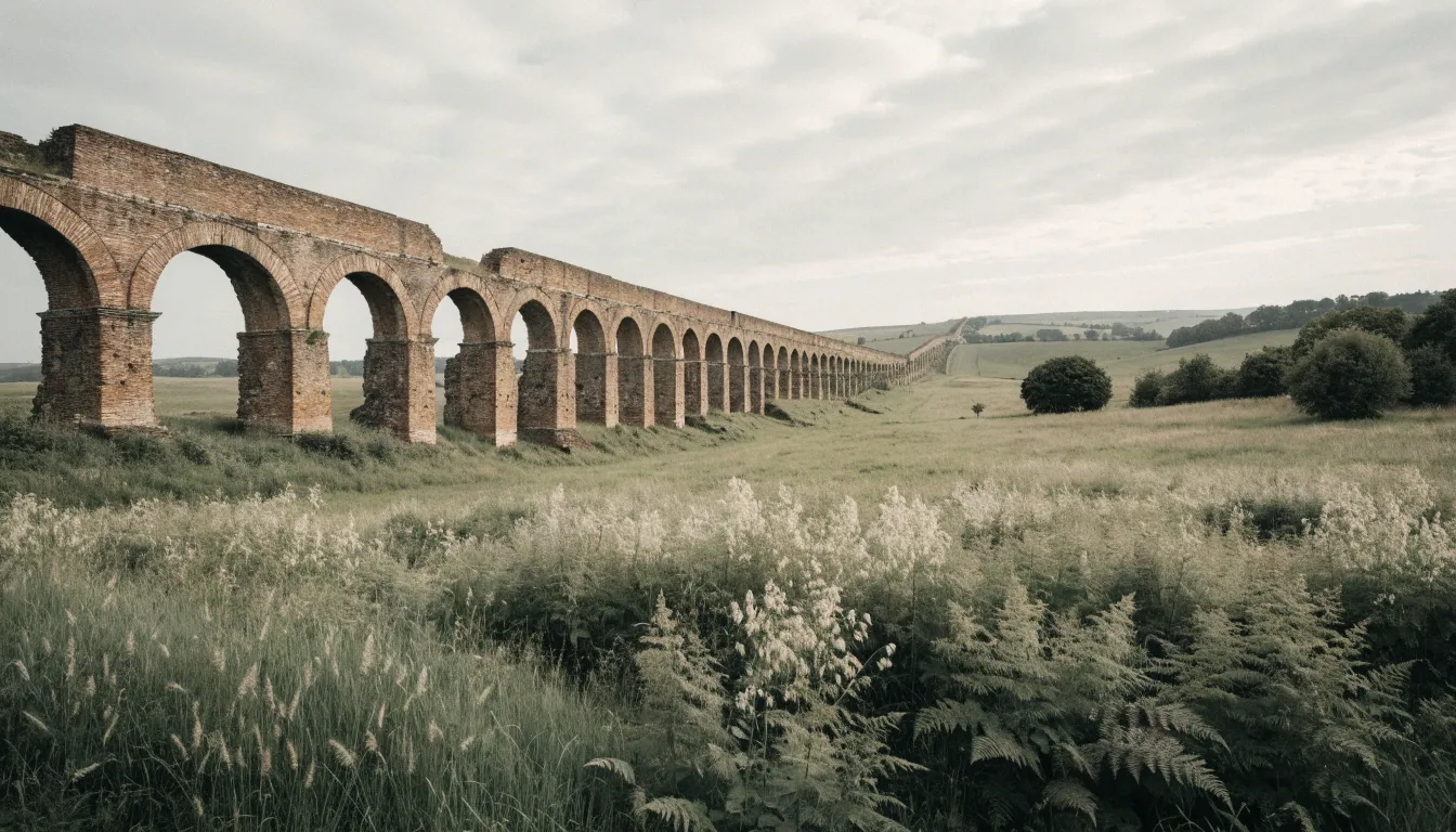
Fifteen kilometres from central Lyon, in a field at Chaponost, a row of Roman arches runs dead straight across the plateau. No railings, no ticket desk, no queue: a dirt track, gardens on either side, and that line of stone and brick carrying on as if nothing had happened. It is the most spectacular surviving stretch of the Gier aqueduct, the longest of the four aqueducts that supplied Lugdunum, and most visitors to Lyon go home without ever learning it exists.
The structure collected water from the Gier, over towards the Pilat massif, and delivered it to the hill of Fourvière. The route is usually described as being in the order of 85 kilometres, with buried sections, bridges and several siphons to get across valleys. The exact date of construction is still debated among specialists, and we are not going to settle it here. What survives, on the other hand, is easy to visit: the remains surface across a dozen or so communes south-west of Lyon, and can be followed by car over half a day or a full one.
The stops below are geolocated. Click “Show on map” to place a site, or “Directions” to start the route from where you are.
-
Plat de l'Air arches, Chaponost
The long run of stone and brick arches crossing the plateau west of Chaponost. It is the most spectacular surviving stretch of Lugdunum's four aqueducts, and it is freely accessible: a path follows the row of arcades for several hundred metres, between meadows and gardens. The figure usually quoted for this row is 72 arches.
Come early or late in the day: low light brings out the alternating courses of stone and brick, which flatten out at midday.
About 15 km from Lyon, in the order of 25 minutes by road to the south-west. Without a car, TCL buses serve Chaponost from the Gorge de Loup and Oullins side. The site is open access, with no ticket and no opening hours.
-
Beaunant siphon
Dropping towards the Yzeron, the aqueduct had to cross a valley too deep for a conventional bridge. So the Romans used an inverted siphon: the water dived into lead pipes, crossed the bottom of the valley and rose again on the far side. What remains are heavy masonry blocks, the piers of the bridge that carried the pipework.
The pin is approximate: it places the siphon area, not a precise entrance. Follow the local signposting once you are there.
-
Soucieu-en-Jarrest remains
You work back up the line, into the hills west of Lyon. Around Soucieu-en-Jarrest the route surfaces in pieces: sections of channel, isolated arches standing in fields, sometimes a wall absorbed into a farm boundary. This is an aqueduct in fragments, and that is precisely what makes reading the landscape worthwhile.
A sector marker, not an address. The remains are scattered across several points in the commune: trust the panels and the waymarked paths.
-
Garon siphon bridge
Towards Mornant the works cross the Garon valley by a second siphon. Same principle as at Beaunant, same masonry, but a different setting: open countryside, with remains emerging from the vegetation. This is where the scale of the original building site becomes physical rather than theoretical.
Note: this pin carries the same coordinates as the Mornant one. It is a shared sector marker, not a separate survey point. Follow the local signposting.
-
Mornant
The town that commands this stretch of plateau, with its old streets and aqueduct remains within walking distance. It is the natural place to restock during the day, and the easiest place to park before heading back out to the neighbouring sections.
Same caveat: the pin is shared with the Garon stop and stays approximate. It puts you in the right area, the signposting does the rest.
-
Chabanière remains
Higher still towards the source, in the commune of Chabanière, the line dissolves into the hills. The remains are more modest than at Chaponost and harder to spot, which is exactly why it is worth finishing here: you leave the monument behind and meet the engineering, the long patient channel that went looking for the Gier's water much further out.
Approximate pin, at the scale of the commune. Plan to walk a little and accept some searching: that is the price of a site with no ticket desk.
1. The Plat de l’Air arches at Chaponost
Start here, because this is where the aqueduct still stands over a real distance. The row of arcades crosses the plateau west of the village, and you can walk alongside it for several hundred metres, between meadows and garden fences. The figure of 72 arches is the one quoted everywhere for this run: we repeat it as given, without having counted them ourselves.
What strikes you close up is the masonry itself: courses of rubble stone alternating with bands of brick, a building technique you can still read at eye level. Come early in the morning or late in the day if you can. At midday the light flattens everything and the arches turn into a grey silhouette; in low light the alternating materials jump out at once.
The site is open access. No ticket, no opening hours, no visitor building. That is a gift and also a responsibility: stay on the paths and do not climb on the masonry.
2. The Beaunant siphon
Second stop, a little closer to Lyon, where the aqueduct had to cross the Yzeron valley. The dip was too deep for an ordinary bridge, so the Roman engineers used an inverted siphon: the water dived into lead pipes, crossed the valley floor under pressure, then rose again on the far side back up to the level of the channel.
The lead is long gone, of course. What remains are the heavy masonry blocks that carried the pipework, planted in the suburban landscape of Sainte-Foy-lès-Lyon and Saint-Genis-Laval. It photographs less well than Chaponost and rewards you far more once you understand it: you are standing in front of a hydraulics problem solved two thousand years ago.
The map pin is approximate. It places the siphon area, not a precise entrance: once you are there, follow the local signposting.
3. The remains at Soucieu-en-Jarrest
From here you work back up the line, into the hills west of Lyon. Around Soucieu-en-Jarrest the aqueduct is no longer a monument but a trace: sections of channel, a few isolated arches in the middle of crops, sometimes a stretch of ancient wall absorbed into a farm boundary.
That is a shift in how you look, and it is the real lesson of the day. You stop hunting for the postcard and start reading the landscape: a hedge following a line that is too straight, a bank that has no business being there. The map marker here is again a sector marker, at the scale of the commune. On the ground, trust the information panels and the waymarked paths.
4. The Garon siphon bridge
Towards Mornant the works cross the Garon valley by a second siphon, on the same principle as at Beaunant. The setting could hardly be more different: open countryside, with masonry remains emerging from the vegetation without warning.
One point of honesty: on our map this pin carries exactly the same coordinates as the next stop. It is a sector marker shared by both, not two separate survey points. It puts you in the right place to within a few hundred metres, and the local signposting does the rest.
5. Mornant
The town that commands this stretch of plateau. Old streets, a central square, aqueduct remains within walking distance: it is the natural place to restock during the day and the easiest place to park before heading back out to the neighbouring sections.
Give it an hour. Heritage routes have a way of stacking up quickly by car until you stop looking at anything at all; a pause in a real village puts the day back on its feet. Same caveat as above about the map pin, shared with the Garon stop and approximate.
6. The remains at Chabanière
Last stop, higher up towards the source, in the commune of Chabanière. Here the line genuinely dissolves into the hills. The remains are more modest than at Chaponost, harder to spot, and you have to accept doing some searching.
It is still the right way to finish. You leave the monument behind and meet the engineering: a patient channel, tens of kilometres long, that went to collect water much further out again and brought it back, on an almost imperceptible gradient, to a hill in Lyon. The pin is approximate, at the scale of the commune. Plan on walking.
Getting there from Lyon, by car or public transport
By car, reckon on about 15 km and in the order of 25 minutes to Chaponost, heading south-west. It is by far the most flexible option, because the remains are scattered across several communes and nothing links the stops together except the road.
Without a car, Chaponost is still reachable: TCL buses serve the commune from the Gorge de Loup and Oullins side. Check the timetable for the day before you leave, it changes with the day of the week. On public transport alone, aim for the Plat de l’Air arches and give up on the southern stops: those need a car.
How long? Half a day is plenty for Chaponost and Beaunant. Allow a full day if you want to work back up to Mornant and Chabanière. And wear closed shoes: the approaches are dirt tracks, not park paths.
Back in Lyon
The Gier aqueduct sits well alongside the rest of the region’s ancient heritage. If the subject grabs you, Vienne in a day gives you the complete Roman town, temple and theatre included, half an hour south by train. And for an outing of the same length but built around walking, the Monts d’Or head off in the opposite direction, to the north-west.
Once you are back in town, if the day left you wanting to carry on into the vineyard side of things, our guided route takes place in vaulted cellars in the Guillotière district. The practical information is here.